Getting Around
Located directly south of the City of Guelph and east of the City of Cambridge, the Township of Puslinch’s close proximity to major cities offers convenient access to amenities.
Defining the Township are many individual communities. Each one has its own unique landmarks, landscape and personality. The abundance of sites to explore make the Township of Puslinch a rich and refreshing place to visit.
We invite you to discover the Township of Puslinch.
The communities that make up the Township of Puslinch:
Aberfoyle
Aberfoyle is considered the administrative centre of the Township of Puslinch and is home to the Township’s Administrative Office, Fire Station, Puslinch Community Centre, and the Optimist Recreation Centre.
This charming community is located at the headwaters of Mill Creek, approximately ten kilometers south of the City of Guelph.
History
John McFarlane immigrated to Puslinch in 1834. The community officially settled in the 1840’s and was named by McFarlane after his own birthplace in Aberfoyle, Perthshire, Scotland. In 1842 he opened a general store on lot 17, rear concession 7. This store is regarded as the first general store in North Puslinch.
Although the village materialized during upgrades made to Brock Road in 1848, there was residency and business active in the area decades prior. Blacksmith’s, wagon shops, and hotels all had thriving roles in the Aberfoyle community before it received its name.
Did you know?
Perhaps the most popular landmark in Puslinch is the Aberfoyle Mill. The land was originally owned by Patrick Mahon; an Irish immigrant who came to Canada in 1829. He developed a hydroelectric dam on land which he later drained before selling to George McLean; a Highland Scot who immigrated to Puslinch in 1831.
George McLean and his friend, Peter Clark, had a previous mill, called “Puslinch Mills”*, in Morriston which burned down c. 1861. Records from “Puslinch Mills” shows six employees employed. Five men who worked for $85 a year, and one woman, who worked for $4 a year. The lot for the mill was relocated to Aberfoyle and was constructed using brick from the Morriston brick yard. The exact date of construction is unknown, but is estimated to be sometime as early as 1859, or as late as 1868.
In the last century, the Aberfoyle Mill has been repurposed as a restaurant.
Aikensville
Located along Country Road 34 in West Puslinch, the Aikensville hamlet is a quiant area with a personal history for many Puslinch residents.
History
Aikensville’s history has a deep-founded connection with its residents. A fact that may be unknown to many is that Aikensville received its name from the Aikens family. Members of which still live in the area today.
It is unknown the exact date when the hamlet was given its name, however, the Aikens family has resided in this area, continuously, since before 1858.
A public house operated in this area c.1861-1877. However, governmental limitations eventually caused the tavern to fail, leaving behind an empty building. Since people in the Aikensville community had to travel to Aberfoyle or Hespeler to collect their mail, Post Master Donald McCaig decided to establish an office in the hamlet in 1909. The site of this post office has been speculated to be the old public house. The post office closed in 1913 due to the introduction to rural mail when properties became able to receive mail in boxes at the end of their driveways.
Arkell
Located south of Guelph, Arkell is a village with a rich history of English settlement in Puslinch.
Arkell is praised for its stunning nature features. Cyclists and hikers have identified it as an ideal to rest for those touring the country-side roads. Many tourists, such as those hiking the popular trails of Starkey Hill loop or the Arkell Springs trail, keep coming back for the beautiful landscapes, forestry, and picturesque settings.
A notable landmark in Arkell is the Arkell Spring Grounds, which run north-east of the village and produce several fresh water springs along the Eramosa River.
History
John Arkell Immigrated to Puslinch from Kempsford, South Gloucestershire, England in 1830. He came with a group of multiple people, notably; Thomas Arkell, his first cousin. When they arrived, they established the community of Arkell and took up the tract of land now known as the Farnham Plains.
Thomas Arkell lived on the Farnham Plains until the end of his life. He is buried in the Farnham cemetery. Thomas was a knowledgeable and successful farmer who was held in high regard in his community. He was a member of the English church and a Magistrate who was respected for always conducting business in an unbiased manner.
Badenoch
Located north of Puslinch, this charming community has ties to the wave of 19th century Scottish settlement in Puslinch. With lush forests and scenic hiking trails, the Badenoch Village brings character to the Township.
History
In 1831, Donald McLean and Peter Grant travelled with a group from Greenock Scotland to Montreal. The group, including Donald Martin, John Kennedy, and Mr. and Mrs. McBain stayed in Montreal for a winter, while McLean and Grant made their way to Puslinch.
Once McLean and Grant arrived in the spring of 1832, they were directed to a Mr. Stahl who assisted them in selecting lots 29, 30, and 31. McLean built a shanty on lot 31 for him and Grant to live in. When the other families journeyed to Puslinch that same year, they moved in with the men. This humble shanty is the considered the first house in the Badenoch Village.
Over the next few years, more families and friends of the pioneers moved to Puslinch and took up the surrounding lots. By the mid-to-late 1830’s, most of the Badenoch area had become occupied.
In the 1830’s, John Linderman, a Dutch immigrant to Badenoch, built saw mills along the creeks behind these properties. These mills were known around the area as “Linderman’s Saw Mills”. One of the reasons Linderman’s saw mills were so well-known was because they were the first of their kind in this part of the country. Linderman went on to operate these mills until he died in 1853.
Barber’s Beach
In recent years, Barber’s Beach has been transformed in to a residential area.
History
However, in the late 1800s, Barber’s Beach was known as the summer playground where residents of Wellington and Waterloo counties travelled to enjoy the beautiful weather and fine white sand. During this time, Barber’s Beach was the place of all places where there was never a shortage of families picnicking on the sand, children riding the miniature train through the bush, or visitors of all ages enjoying the famously delicious French fries and gravy at the lunch bar. Barber’s Beach was just as lively at night as it was during the heat of the day thanks to the beach party dances that were hosted in the pavilion.
At one point before 1900, there were five summer hotels on the north shore that visitors took buggy rides in to visit from local communities. In 1928, the Toronto Star reported that on Canada Day weekend 6,000 people came to Puslinch Lake to see the Sunday swimming race involving George Young, a swimming champion from Toronto. Barber’s Beach continued to be a popular summer destination for decades. In 2000, Barber’s Beach was bought by investors who built the gated community of luxury homes known as Irish Creek Estates.
To learn more about the history of Barber’s Beach, a great source of information is Anna Jackson’s, “Puslinch Lake and Its Past”, published by the Puslinch Historical Society.
Corwhin
Located in North Puslinch, along Wellington Rd 34, Corwhin is a community with a rich history.
History
In the Corwhin community, when the settlement began, the area was separated from the west because of the swamps connected to Mill Creek. Since there was a large disconnect between the West, the community looked east to the nearby border of Puslinch and Halton. Until about 1887, the hamlet was located at the Townline. However, after 1887 the Guelph Junction Railway came through and had a significant impact on the community.
The regular train was steam powered, but a separate battery operated car was provided for local use. When this new battery car was introduced, locals were quick to give it the name “Sparkey”. For 25 cents an hour, anyone who wished could travel between Guelph and Guelph Junction on any of “Sparkey’s” daily runs. Humourously, one account of a ride on the line suggests that the passenger had never been as scared in his life as when he rode from Corwhin to Guelph for the first time.
Did you know?
Outside the Station House store at Corwhin was a sign that announced the entrance into “Corwin”. Over the years, many have wondered whether this was a spelling mistake or if the “h” was added to its name in later years.
It can be seen by Corwhin’s past that it is a community that is continuously growing and advancing. Although this may be true, Corwhin is still very connected to its community and roots of the past.
Crieff
History
The village of Crieff was formerly known as Fraserville after the family whose farm the village originated from. By 1871, the village’s population had reached 50. Crieff became a thriving community with two blacksmith shops, two stores, a hotel licensed to sell liquor, a shoemaker, a church with a minister, and various dwellings.
Did you know?
Around 1882, The Kerracher Hotel, the local hotspot, caught fire and was destroyed. To add to the distress of losing The Kerracher, the fire that destroyed the hotel carried a blaze, also burning down the Temperance Hall. Although it was difficult for Crieff to recover after losing two buildings essential to the village’s vitality, the village eventually bounced back . Today, Crieff is a beautiful and thriving community.
Killean
History
The discovery of Killean took place in 1831 when David Gibson was surveying the western part of Puslinch. David Gibson and his immigrant crew member, Peter Blue, took an immediate interest in the intersection of Concession 1 and Mill Creek because of its interesting landscape and environment.
Once the first settlers had established their own houses to live in, they began to build a school and church. The first church in Killean was built in 1840 and was made out of log. Every fourth Sunday, the minister and congregation from the East Presbyterian Church would worship. Years later, the first school was built out of stone along with the first store in Killean, which marked the beginning of Killean as a community.
Another important piece of Killean’s history was the Killean Cemetery. The first burials at the cemetery were in 1834. The cemetery is still maintained by volunteers and burials are still performed today.
Allowing easy access to the outside world was the Credit Valley Railways, which was built in 1879-1880 just 0.6 km south of the hamlet. The station was mistakenly named Leslie, but was commonly known as Killean station until it became official around 1915.
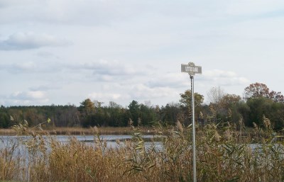
Little Lake
Puslinch Lake is a kettle lake in Wellington County. It has been deemed the largest kettle lake in all of North America. Connecting the channel to Puslinch Lake is Little Lake, which is located to the northeast. The lake provides recreational activities such as swimming, fishing, sailing, boating, and waterskiing.
As you can tell by the name, Little Lake is not large in size. However, a variety of fish and species can be found living in and around Little Lake, which makes it an interesting and exciting lake to explore.
History
At one point in time, Little Lake formed part of a Mohawk Indigenous reserve. Indigenous peoples in this region utilized the resources around the lake for centuries before the colonizers began to settle. It was possible this area was avoided by settlers for so long due to the lack of Beavers; the fur of which was a valuable trading resource.
The first settler was Alex Lamont, who purchased lot 6 on the North shore of Little Lake in 1831. His youngest son tragically drowned in the lake and was the first recorded death and burial of Little Lake. After him, James Little settled north of the lake in 1838. Before either of these men, there was a legend of a local Frenchman called, “The Monk”. It was said that he lived in seclusion on the Big Island during the 1820’s, but once settlers began to take up lots around 1830, “The Monk” skipped town, leaving behind no record of who he was or where he came from.
In early days, it was common for performances and dances to held on the island. People would gather to listen to the music flow over the still water and dance the warm summer’s night away. Locals violinists, Archibald Ramsay, William Young, Anthony Robertson, along with accordionist August Bergerow would play for the community.
As the years passed and the technology changed, the lake became somewhat secluded. But, at the 20th century came around, the lake was considered “rediscovered” and is now beloved for its beautiful clear water and timbered shores.
Morriston
Morriston is a beautiful village south of the Highway 401 interchange along a narrow, two-lane section of Highway 6. As with many other villages in the Township of Puslinch, Morriston proudly exhibits its historical buildings by allowing the insides of these buildings to be used by local businesses.
If you’re looking to get outside and spend some quality time with family and friends, you can rent some space at Morriston Meadows to play at the ball park or enjoy a picnic at the picnic pavilion.
History
Morriston is known for its history of German settlement in the Township. German culture prevailed for many years in this area and is still felt today.
Morriston had many businesses and amenities in its hay-day, with remnants existing today. In 1856, a church was constructed using brick from the “Morriston Brick Yards”–a yard which provided brick for buildings all around Puslinch. This church was built on the road from Brock to Victoria and is still used today as the “Morriston United Church”.
A fun fact is that the Morriston Hall, built 1858, was equipped with cells in the basement. Making it the only jail to ever be constructed in the Township of Puslinch.
Puslinch
The Township of Puslinch embraces nature, tradition, and heritage. If you appreciate an active outdoor lifestyle, you will enjoy the wealth of recreational opportunities in the quaint countryside of the Township of Puslinch.
The Badenoch Tract, located on Watson Road just minutes north of Highway 401, is a popular destination for those who like activities such as hiking, mountain biking, and horseback riding. The Starkey Loop Trail on Starkey Hill is another rustic walking route that winds through the forest. From the peak of the Starkey Loop Trail, you can see Guelph’s famous Church of Our Lady in the distance.
The Township of Puslinch offers you the chance to surround yourself with nature and appreciate the more simple things in life.
History
Majority of the early settlers to the Township were Highland Scottish. Other groups, including English, German, and Irish, created settlements in the Arkell, Morriston, and Brock road area respectively.
The name “Puslinch” was chosen by Governor Colborne of Upper Canada (Ontario) who named it after an estate he desired in Devonshire, England. However, Puslinch has not always been recognized by this name and has, throughout history, been identified as Puselynch, Posselinch, and Puzzlewitch.
The first hamlet of Puslinch began at Adam Black’s Hotel along Brock Road. It was located on family property and eventually burned. During these years, the hamlet stretched to Crieff crossroad where a store was owner by Donald and Lewis Ferguson. As well, Dan McIntosh owned a tailor shop on Lot 36, west of Brock Road. These names were among the first pioneers to Puslinch.
Since the 19th century, Puslinch has sprouted into a vibrant Township with a strong community and rich history. Stay for a while and explore all that the Township of Puslinch has to offer.